
Tennessee ZIP Code Directory Coverage
Tennessee does not have one official static table that lists every currently deliverable five-digit postal code with its post office. These regional bands are supported geographic clusters, not a complete live USPS roster. Postal boundaries can cross county and city lines, and some codes serve boxes or a single institution instead of a normal residential area.
| ZIP family | Areas covered | Post office or postal city | Notes |
|---|---|---|---|
| 370xx–371xx | Nashville and Davidson, Antioch, Madison, Hermitage, Brentwood, Franklin, Clarksville, Murfreesboro, Gallatin and nearby Middle Tennessee towns | Nashville and regional post offices | Mixed city, suburban and unincorporated coverage; assessor systems vary |
| 372xx | Nashville urban areas, PO boxes and unique facilities | Nashville | Postal city pockets cross city and county contexts; Metro Parcel Viewer has a ZIP filter |
| 373xx–374xx | Chattanooga, Cleveland, Manchester, Tullahoma, Winchester, Dayton and Crossville areas | Chattanooga and local postal cities | Central TNMap excludes Hamilton and Bradley counties |
| 375xx–378xx | Knoxville, Oak Ridge, Maryville, Sevierville, Pigeon Forge, Gatlinburg, Morristown, Johnson City, Bristol and Kingsport areas | Knoxville and East Tennessee postal cities | County systems differ; check local parcel coverage |
| 380xx–383xx | Memphis, Germantown, Collierville, Jackson, Dyersburg, Covington, Brownsville and Union City areas | Memphis and West Tennessee postal cities | Memphis and Shelby use local assessor and GIS routes |
| 384xx–385xx | Columbia, Lawrenceburg, Pulaski, Lewisburg, Cookeville, Sparta, Livingston and Jamestown areas | Columbia, Cookeville and regional offices | Check the physical county with parcel data |
| 386xx–388xx | West Tennessee border and Delta communities using Memphis-region postal routing | Memphis-region routes and local offices | Postal names can cross county or state assumptions |
| 420xx, 421xx, 426xx | Northwest and north-central Tennessee border communities | Kentucky postal routing may be used | A postal city outside Tennessee does not set the parcel's legal county |
| 240xx, 242xx, 376xx, 377xx | Northeast border communities near Virginia and North Carolina | Virginia, North Carolina and local postal relationships | Postal city and Tennessee municipality can differ |
These regional bands organize a search; they are not a complete live USPS roster. Verify the address with USPS, then use a Census ZCTA only when a mapped area is needed. Use county parcel GIS to establish the physical county and municipality. A printed regional table should carry its check date because mail routes, names and postal boundaries can change.
Middle Tennessee ZIP Families
The Middle Tennessee bands collect postal cities with very different local footprints. Nashville can include central city blocks, county pockets, suburban places and unique or box-only routes. Other families reach places such as Clarksville, Murfreesboro, Franklin and Gallatin. The name printed as a postal city is a mailing label, so it does not by itself tell which city government, county assessor or election commission holds a record.
The regional pattern is useful for choosing a first portal. TPAD covers 86 counties, but Davidson, Montgomery, Rutherford and Williamson are among the counties linked to separate assessment systems. The centralized TNMap viewer also excludes Sumner. A Tennessee postal search that starts with the wrong county can therefore miss the local map or assessor, even if the mail address looks familiar.
Nashville is the clearest local example because its Metro Parcel Viewer accepts a ZIP filter along with city, street, owner, parcel, zoning and district options. A code near the edge of the city may still need a parcel check for its actual county and tax district. Use that local filter to narrow mapped property records, not as a statewide resident count.
East Tennessee ZIP Crossovers
East Tennessee families span mountain towns, valleys and border communities. The 373xx–374xx bands include Chattanooga and communities around Cleveland, Manchester, Tullahoma, Winchester, Dayton and Crossville. The 375xx–378xx bands group Knoxville, Oak Ridge, Maryville, Sevierville, Pigeon Forge, Gatlinburg, Morristown and the Tri-Cities. These are geographic clusters, not one boundary shared by postal, county and city offices.
Parcel routing matters around Chattanooga and Cleveland because the centralized TNMap display excludes Hamilton and Bradley counties. Knoxville is also outside the centralized TNMap coverage, and Sumner and Williamson use local routing for that viewer. Select the county first, then follow the local assessor or GIS link when the central map sends the search elsewhere.
Border families show the oddest postal mismatch. Some Tennessee addresses in the 420xx, 421xx and 426xx bands use Kentucky postal routing; communities in the 240xx, 242xx, 376xx and 377xx bands can have Virginia or North Carolina postal relationships. For these addresses, keep the postal city in one field and confirm the Tennessee parcel county in another. The postal name can sit outside the state's legal boundary without moving the property.
West Tennessee ZIP Families
The 380xx–383xx cluster covers Memphis and Shelby County, as well as postal cities such as Germantown, Collierville, Jackson, Dyersburg, Covington, Brownsville and Union City. The 384xx–385xx bands continue through Columbia, Lawrenceburg, Pulaski, Lewisburg, Cookeville, Sparta, Livingston and Jamestown. Mailing-city groupings stretch beyond the boundaries readers may expect from the large city names.
Memphis and Shelby are a strong example of local property routing. The statewide property assessment interface points Shelby users to its separate system, and centralized TNMap does not display Shelby County parcels. A ZIP city name such as Memphis can also refer to a postal service area rather than the City of Memphis. Use the parcel map for the actual jurisdiction and the local assessor for the record that map points to.
The border and Delta families make a county check just as useful outside the larger centers. A postal city can be shared by several counties, or a Tennessee property can carry an out-of-state postal name. Postal families are routing aids; the deed, assessor and municipal map answer different questions.
Finding Tennessee Residents by ZIP
A postal filter can narrow a record search, but it cannot create a resident list from records that do not have that field. The GoVoteTN tool can look up one person by first and last name with an optional ZIP, or by street address and ZIP. It returns ballot, polling-place and district details. The state's registration lookup instead requires county, first name, last name, birth month and birth year. Neither form is a ZIP-wide export of every resident.
- Start with a complete address and verify its postal route through the current USPS ZIP lookup. Save the standardized postal city and the date checked.
- Use the Census ZCTA file for a generalized map area or population context. Do not treat it as an exact boundary for every USPS delivery point.
- Check the physical parcel in the county assessor or GIS viewer. Nashville has a local ZIP dropdown; TPAD requires a county and its address field can accept a street without a number.
- For an individual voter match, use GoVoteTN's name-and-ZIP or address-and-ZIP path. For a full voter file, ask the Coordinator of Elections or county commission for current terms and fields.
Once a postal band is narrowed to a physical street, the Tennessee street directory follows the address-based record chain. Keep the ZIP, postal city, legal county, source and query date in separate fields so one label does not replace another.
Tennessee ZIP Search Fields
The ZIP-capable parcel portal identified for this area is Nashville's Metro Parcel Viewer, a Davidson County tool rather than a statewide map. Its filter set can narrow the map by city and ZIP and then pivot to a street, owner, parcel, zoning or district view. GoVoteTN has a separate voter lookup flow that pairs a person's name or street address with a ZIP.
| Portal field | Search form | What it can narrow |
|---|---|---|
| City and postal code | Dropdown filters in Nashville Parcel Viewer | Davidson County mapped property results |
| Street, owner, parcel or description | Text or parcel lookup in Nashville Parcel Viewer | Property, ownership, zoning, assessment and permit detail |
| Zoning, overlay, land use, council or tax district | Map filters and layer choices | Local planning and district context |
| Custom shape | Drawn map selection in Nashville Parcel Viewer | Properties inside a user-drawn area |
| Name or address plus ZIP | GoVoteTN individual lookup | Sample ballot, polling place, elected officials and districts |
For statewide property work, TPAD starts with a county and searches by owner name, address or parcel ID; it has no documented statewide ZIP filter. TNMap also asks for the county first, then an owner, address or parcel. This difference is the reason to route by both the postal area and physical county, not by the ZIP label alone.
USPS ZIP History in Tennessee
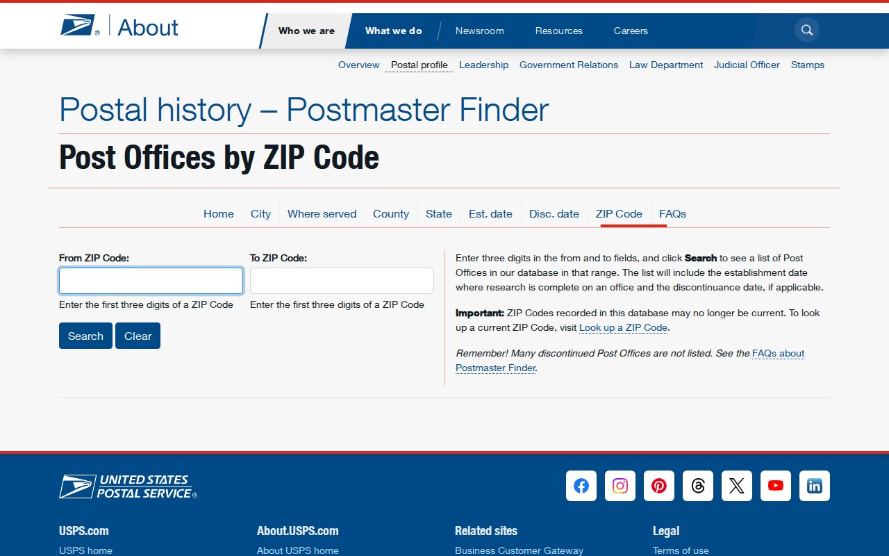
USPS's Postmaster Finder is a historical tool that accepts the first three digits of a ZIP family and can show post-office names plus establishment or discontinuance dates when its research is complete. USPS warns that the codes in this historic database may no longer be current and that many closed offices are not listed. Use its current address lookup for an active delivery ZIP; do not read the historical screen as a current statewide directory.
The USPS first-three-digit post-office search shows its range fields and historical post-office results.
This source is useful for postal history and old place names. A current Tennessee address still needs the live USPS lookup and a separate parcel check.
Tennessee ZIPs and ZCTAs
A USPS ZIP and a Census ZIP Code Tabulation Area are different kinds of geography. USPS assigns delivery routes through post offices. The Census Bureau's ZCTA guidance describes generalized polygons drawn from 2020 Census blocks, which help map and compare places but do not trace each current postal boundary. Not every valid USPS code gets a ZCTA; a unique institutional route or a PO-box-only code may have no ordinary residential polygon.
That makes the Census layer useful for broad population or map context, but not for proving that a parcel sits inside the exact delivery area. A mapped ZCTA can smooth edges or leave out a code that still receives mail. When a Tennessee map has a blank around a box-only or unique code, that absence does not show that the USPS code is invalid. It may simply be a type of route that Census does not map as a residential polygon.
For a defensible result, write down which geography the source supplies. Use USPS to confirm a deliverable address or postal city, a Census ZCTA to map a generalized area, and parcel GIS to identify the legal county and tax district. When a number is used in a table or map, retain the file year and the query date. The method is more useful than a frozen claim that every code has a matching polygon.
Tennessee ZIPs vs City Lines
Postal boundaries do not set municipal boundaries. A ZIP can cross a county or city line, serve an unincorporated neighborhood, or use a nearby town's name for mail. A Tennessee address with a postal city outside the municipality still belongs to the physical parcel's county and local government. Annexation and deannexation can also change the city context without changing the postal route at the same time.
Road names and street numbers can be assigned locally too. Tennessee law gives counties and municipalities authority over road names and property numbers in their areas, subject to USPS acceptance. Nashville's late-1904 street changes and Memphis's 1905 building-number change show why an old postal address can fail a modern parcel search. Check local E911 or GIS, road ordinances, plats, USPS, assessor records and a historical library when a past address does not line up.
- ZIP and ZIP+4
- The five-digit ZIP names a postal delivery area; ZIP+4 adds four more digits to the postal address. Confirm the full current format with USPS.
- PO-box-only ZIP
- A code used for post-office boxes rather than regular street delivery; it may have no residential parcel boundary.
- Unique ZIP
- A code assigned to one institution or corporation instead of a broad neighborhood area.
- Carrier route
- A postal delivery path within the service pattern of an office, not a legal city or county line.
- ZCTA
- A generalized Census map polygon built from blocks, not the USPS delivery boundary itself.
Tennessee ZIPs Do Not Identify Residents
A match to a ZIP is not proof that a named person lives at an address. A voter lookup is a one-person registration and district tool. An assessor record names an assessed owner, whose mailing address may differ from the parcel and does not list every person who uses that property. A postal city can cover several local jurisdictions, and a ZIP can include boxes or a unique institution instead of homes.
Keep the question narrow. If the aim is to confirm a postal route, use USPS. If it is to map a broad population area, use the Census ZCTA and name its year. If it is to locate land or a tax district, use the county parcel source. For a person-specific election question, use GoVoteTN or the state registration lookup and accept the privacy limits on voter and absentee records.
These Tennessee postal clusters route a search toward the right local record office, not to an all-resident file. USPS says its address result does not establish that a person or business is actually at the address. Compare the source that answers the postal question with the custodian that answers the property, election or identity question before treating two records as one person.