
Find a Tennessee Street by Address
A Tennessee street search is a chain of records keyed to a place. Start with the county because the state has no single deed index, and local assessment systems differ. The public parcel roll identifies an assessed owner and a physical parcel; it does not name everyone who may live there. Keep the parcel, the person, and the date attached to each result. A directory entry or voter match can add a different kind of evidence, but neither turns the property record into a full household list.
- Choose the county where the street lies, then search the assessor portal. Tennessee Property Assessment Data (TPAD) covers most counties and accepts an address without a house number.
- Record the owner name, parcel ID (the assessor's identifier), situs address (the property's physical location), and mailing address (where tax mail goes) separately.
- Open the parcel in the TNMap Property Viewer or the county's geographic information system (GIS), then note adjacent parcel IDs and relevant layers.
- Use the owner name and legal description (the deed's formal description of the land) to search the county Register of Deeds index for the acquisition deed and earlier owners.
- Use a one-person voter lookup only when you have the required details, then check dated city directories for historical occupants.
If a road crosses county or municipal lines, split the search by jurisdiction before using one portal. The same street can lead to more than one assessor or local records office.
TPAD Fields for Tennessee Streets
The Comptroller's Tennessee Property Assessment Data (TPAD) search starts with a county and a search term. The statewide screen serves 86 counties; Chester, Davidson, Hamilton, Hickman, Knox, Montgomery, Rutherford, Shelby, and Williamson use linked external assessor systems. The county choice is therefore part of the search, not a minor filter.
The screenshot below shows the county selector on the TPAD property search. Its advanced form adds parcel and property filters for a narrower match.
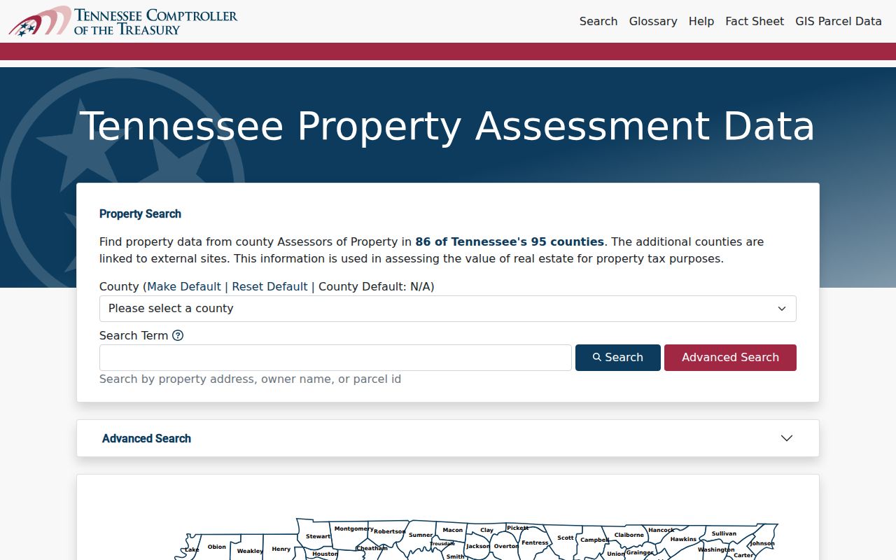
A blank result can mean the wrong assessor system or a different spelling, not that a parcel is absent.
| Search field or control | How it works | Required or format |
|---|---|---|
| TPAD: County | Sets the local assessment source. | Required selection. |
| TPAD: Owner Name | Searches the assessed owner; partial or abbreviated styles may work. | Optional text. |
| TPAD: Property Address | Can search a street without a house number. | Optional text. |
| TPAD: Subdivision Name | Narrows to a named development. | Optional text. |
| TPAD: Classification | Uses local property classes. | Optional; choices vary by county. |
| TPAD: Sale Date | Limits results to a date range. | Optional start and end. |
| TPAD: Control Map | Uses the county control-map field. | Optional text; three digits with up to two letters. |
| TPAD: Group | Uses the parcel group field. | Optional text; up to two letters. |
| TPAD: Parcel | Uses the parcel component. | Optional text; five digits, with an optional decimal after the third. |
| TPAD: Sort By | Orders results by owner, address, parcel ID, subdivision, class, or sale date. | Optional choice. |
| TPAD: Search / Reset | Runs the query or clears the form. | Buttons. |
| TNMap: County and primary search | Choose a county, then search by owner name, property address, or parcel ID. | County first; partial owner, street, or map number may work. |
| TNMap: Advanced search | Adds address, owner, parcel ID, subdivision, sorting, and other criteria. | Optional fields vary by county. |
| TNMap: Map tools | Select a parcel, open layers, zoom to results, or print. | Viewer controls. |
An inspected TPAD result also shows the fields that connect a search row to a map:
- Owner: BYRD FAMILY PROPERTIES; property address: HWY 109 N 350.
- Control map 079, parcel 069.12, and combined parcel ID 079 06912 000.
- Subdivision EASTGATE BUSINESS PARK, lot 2, and commercial class.
- Sale date 3/2/2016 and a GIS Map link.
- Text filtering, column sorting, page controls, and a count of filtered records.
Rows can show an owner, property address, control map, group, parcel, parcel ID, subdivision, lot, class, sale date, and a GIS link. Building details and photos vary by county. Treat an owner or mailing address as tax-roll evidence, not proof of who occupies a building.
Note: A county-level external link may use different parcel labels and search rules, so keep the system name and query date with each result.
Tennessee Street Parcel Map Layers
TNMap is the statewide map route for counties in its centralized viewer. Pick a county, search by owner, address, or parcel ID, then select a parcel on the map. The current viewer can show basic details and link to assessment data; layer and print controls help compare a lot with nearby streets and parcels. Some counties use their own map instead, and the list of exclusions can change with service updates.
The TNMap help page documents partial street, owner, and map searches, direct parcel selection, advanced search, printing, and layer controls. The image records that 2024/2025 interface guidance.
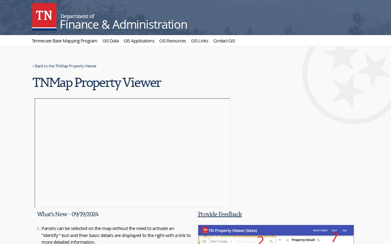
TNMap's centralized viewer excludes Bradley, Davidson, Hamilton, Knox, Montgomery, Rutherford, Shelby, Sumner, Williamson, and Unicoi counties. Use the local assessor or GIS link for those counties. A mapped boundary is useful for finding adjacent parcels, while the recorded deed and plat control legal descriptions and title questions.
Tennessee Street Directory Records
A Tennessee street directory combines dated address records, but each record comes from a different custodian and answers a different question. Tennessee has 95 county Registers of Deeds and no shared statewide deed-search portal. Cities and counties may also keep permits, code files, or planning records by address. The state and local directory helps route a question to the county or municipality that holds it.
| Record | Keeper | What It Can Show | Access route |
|---|---|---|---|
| Assessment card | County assessor | Assessed owner, situs and mailing address, parcel ID, value, class, sale and exemption clues. | TPAD for 86 counties; local system for exceptions; office or request. |
| Parcel map | TNMap or local GIS | Parcel shape, road, nearby lots, and available district or land layers. | Map viewer; features vary by county. |
| Deed index | County Register of Deeds | Grantor, grantee, recording date, instrument reference, and legal description. | County portal or counter; older books and microfilm vary. |
| Permit or code record | City or county office | Application, issue, inspection, or close dates; work and listed parties where public. | Local portal, counter, or request. |
| Voter record | County election commission and state tools | One registration match, status, or district details, subject to limits. | Individual lookup; a full voter file is a separate request. |
| Historical directory | Local library or archive | A dated name, address, and other fields printed in that volume. | Local shelf, microfilm, or digitized run when available. |
The parcel ID often bridges the assessor and map. The deed's legal description may explain a split or an older lot, while a permit can date work at the property. A city directory adds an annual snapshot, not a current roster. Preserve each record's custodian and date instead of merging unlike fields into one claim.
Separate Situs From Mailing Address
Three address-related fields can appear beside one Tennessee parcel. The situs address is the property's physical location. The mailing address is where the assessor sends tax notices. The legal description identifies the land by lot, block, subdivision, metes and bounds, or another recorded description. A parcel ID is a county's map or account key that helps connect those records.
- Situs address
- The mapped street address of the property.
- Mailing address
- The address used for owner correspondence, which may be a business, agent, or other location.
- Parcel ID
- The assessor or GIS identifier; Tennessee county formats can differ.
- Legal description
- The deed's description of the land, which may stay useful when a street name or number changes.
- Plat
- A recorded map that lays out lots, blocks, roads, or easements.
These fields answer different questions. A mailing address outside the street is not an error by itself. A homestead exemption can be an owner-occupancy clue, but its absence does not settle who lives at a property. Check the legal description and parcel key before treating two records as the same place.
Trace Tennessee Street Records Through Deeds
A Register of Deeds index usually starts with names, not a statewide address search. The grantor is the person or entity conveying an interest; the grantee receives it. Find the current assessed owner as a likely grantee, then read the deed to confirm the legal description. Search the named grantor as an earlier grantee and continue backward. Direct and reverse indexes, instrument numbers, book and page references, plats, and releases can help sort similar names and parcel splits.
Keep the legal description with each link in the chain. A street address may be absent from an older deed, may refer to a larger tract, or may use a former road name. If the online county index ends, the Tennessee State Library and Archives county microfilm inventory lists older deed holdings by county and record type; its years vary, and searches are arranged around names rather than addresses.
For each parcel, note the current owner, the deed's grantee and grantor, recording date, book/page or instrument number, legal description, and any linked plat or deed of trust. An estate, trust, company, or lender can appear in the chain. A recorded owner is not a count of everyone associated with the address.
Note: TSLA deed-index searches need a county, a name, and a five-year span; they do not search by street address.
When Tennessee Streets Changed Names
Old street names can break a search that uses only the current label. Nashville changed several downtown street names west of the Cumberland River in late 1904: Market became 2nd Avenue, Front became 1st Avenue, and College became 3rd Avenue. The Nashville history account uses directories and other records to show that address continuity.
Memphis has a separate example. A building listed as 338 Main under the old system became 77 S. Main after a 1905 renumbering, as described in the library's Memphis Mysteries record trail. Search the old and new numbers, both street names, and the legal parcel description when moving across that change.
Tennessee Code § 7-86-127 assigns road naming and property numbering authority to local governments or their authorized emergency communications districts, with changes sent to county election commissions. Annexation can also shift which local office handles a record. The TACIR boundary history explains the statewide change after Public Chapter 707 in 2013.
Tennessee Street Permits and Code Records
Permit and code records are local. A city or county portal may show a permit number, address, work type, application or issue date, inspection status, close date, and a listed owner or contractor. Some offices link permit history from a parcel record, while others keep current digital files or older paper records at a counter.
Ask the codes or records office for existing permit and inspection records by exact street address, parcel ID, and date range. A listed contractor or applicant is not necessarily the current owner. A permit date can mark a renovation, addition, demolition, or other work, but it does not establish who lived in the building. Use the parcel and deed as separate checks, and ask the local office which older files remain available.
Tennessee Voter Lookup Has Limits
The Tennessee Voter Registration Lookup is a one-person form. It requires a county, first name, last name, birth month, and birth year. A no-record message directs the user to check the entry and contact the county election commission. GoVoteTN also has name-and-ZIP and address-and-ZIP routes for sample ballots, polling places, districts, and elected officials; its help text says county election commissions supply the data and the tool does not include property-rights voters.
| Voter lookup field | Requirement | Use |
|---|---|---|
| County | Required | Selects the county registration source. |
| First Name | Required | Enter the registration spelling. |
| Last Name | Required | Enter the registration spelling. |
| Birth Month | Required | Helps match the individual. |
| Birth Year | Required | Helps match the individual. |
| Submit | Button | Retrieves registration or absentee information when there is a match. |
This is not a statewide street export. A county voter file is a separate records request with election-law limits and production costs; protected fields such as Social Security number (SSN), driver's-license number, and Department of Safety ID are excluded. Do not infer ballot choice from participation history or try to reverse a protected address.
Note: Public voter-history data can show participation when released, but it does not reveal a person's ballot selections.
When a Tennessee Street Search Is Blank
A missing online row is a reason to check the source path. Confirm the county, try the street without a house number, test common spelling and direction forms, and compare the parcel ID or subdivision if known. If TPAD sends a county to an external system, switch to that assessor. For deeds, search both grantor and grantee indexes and use a name, legal description, or neighboring parcel rather than relying on the street field alone.
Each custodian has other access channels. Search the local portal, then ask about a public terminal or in-person counter. The county assessor or Register can answer by phone which parcel, book/page, or plat to request. A city may accept requests by email, mail, phone, fax, or an online form; existing Tennessee Public Records Act requests can also be made through the local public-records contact. A request should name the record type, address, county, and date range. The law does not make an office create a new street list.
Under the Comptroller's Tennessee Public Records Act guidance, inspection is generally free, while standard copies are $0.15 per black-and-white page or $0.50 per color page under the Office of Open Records Counsel (OORC) schedule; permitted labor or vendor charges may also apply. When prompt production is impracticable, the custodian must respond within seven business days with the records, a denial, or a written time estimate. The state's model request form shows the detail and delivery choices the requester can provide.
Tennessee Street Directory: Online and Counter Records
Online parcel layers give a current mapped view; a public terminal, deed book, or microfilm search can reach a different record and date. Nashville deed indexes on microfilm run from 1784 to 1924, with original books held to around 1960. Shelby's deed indexes reach from the earliest records through 1933 on microfilm, while deeds continue in the Register and archive holdings. Those older name indexes complement, rather than replace, a current assessment card.
For modern parcels, an assessor or GIS portal can sort a street quickly. For older ownership, a counter or archive may be the only route past a county's online cutoff. Tennessee has no statewide deed-index start year, so ask the local Register which years and document images are online before calling a search complete.
Historical occupants require another source. A city directory records a dated listing, not title; the Tennessee city directories page explains the local collections and how to read them. Keep the assessor's owner, the deed's grantor or grantee, and the directory's listed name as separate roles.
Note: Nashville and Shelby archive dates are local holdings, not a single statewide deed-portal cutoff.
The Limits of a Street Directory
A street directory search can connect public records to land and to a dated listing. It cannot show every person connected to a home. Assessment files list the assessed owner, not each household member. Driver address data is restricted by the federal Driver's Privacy Protection Act, and utility customer lists are not public. A blank voter result may reflect a required-field mismatch, a protected address, or the limits of the form.
Tennessee's Safe at Home program gives eligible participants a substitute address for certain public records. It does not erase existing records and cannot replace the address used for property-tax assessment or recorded real-property documents. Protected information should stay protected; use the custodian's stated process instead of trying to infer an address from other records.
Lawful personal research. Public records can support family history, property research, and civic questions. Do not use an address search to stalk, harass, threaten, or expose a protected person.